We are home on hiatus - a vacation from the vacation so to speak - to catch up on some things on the farm. 'Anomaly' was left in Port de Quebec Marina, I will be returning early next week with brother Jerry and our friend Bob to continue on into the Gulf of the St. Lawrence. Ann is attending to some tennis, gardening, and art issues and will rejoin at Prince Edward Island.
To review the trip so far, we have travelled about 460 nautical miles (that's 530 miles to normal people), of which about 80% was motoring due to lack of wind. However the Gulf of the St. Lawrence has been seeing pretty good winds lately, so that should change.
Click on the charts for a larger image:
The next leg will take us around the Gaspe peninsula and south to the Northumberland Straight which separates Prince Edward Island from New Brunswick. This leg is about 560 nautical miles, not counting a possible side trip up the Saguanay River which is advertised to be the largest fjord in North America. The harbors are small and tend to be shallow, many too shallow for 'Anomaly's' 6.5 foot draft. The tidal range in the area is up to 15 feet, which aggravates the problem.

The charts were rendered from MacENC, using raster scanned charts from NOAA and CHS (Canadian Hydrographic Service). Curiously, though medical care is nearly free in Canada and tremendously expensive in the USA, the opposite is true for charts: the entire chart library of NOAA is available free to anyone downloaded from the internet, while the Canadian charts come as node locked sets costing between $80 and $180 each with 7 sets required to navigate from Toronto to Maine. We also carry Navionics electronic charts for use in the Raymarine chart plotter, these are supplied on copy protected CF cards at the discount price of $225 each, 3 are needed to cover the same area. As a backup to these, I have the Navionics charts for the iPhone which contain the same chart data as the CF cartridges, but cost only $10 for a larger area; $20 buys you all of the Great Lakes and the whole east coast of North America. In fact, charts cost more than we are likely to spend on fuel for the trip.
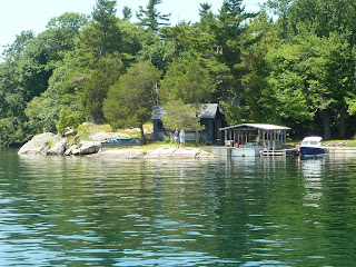
Here are a couple of final images. Sailing through the Thousand Islands:
And a pano from the top of Mount Royal (in Montreal), best viewed by clicking on the image and expanding it, then panning back and forth to get the full effect:
The lower old town of Quebec has been turned into an artsy tourist trap, which did a good job of trapping Ann:
And there is a funicular that will take you right to the front door of the recently opened Starbucks in the Chateau Fontenac. Stairway to Heaven, I called it, as real iced tea is only available throughout Canada at Starbucks:


